Difference between revisions of "AERA 500"
| Line 26: | Line 26: | ||
'''[http://www.usitc.gov/tata/hts/index.htm HTS Code:]''' 8526 91 2099, 8526 91 2010 | '''[http://www.usitc.gov/tata/hts/index.htm HTS Code:]''' 8526 91 2099, 8526 91 2010 | ||
| − | ► Click | + | ► Click to view official OEM's brochure No. [[M02-10196-00]]. |
==Part Numbers== | ==Part Numbers== | ||
{| class="wikitable" | {| class="wikitable" | ||
Revision as of 15:34, 27 May 2015
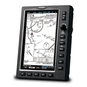
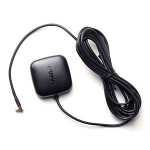
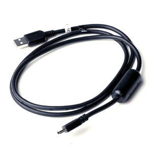
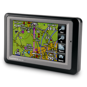 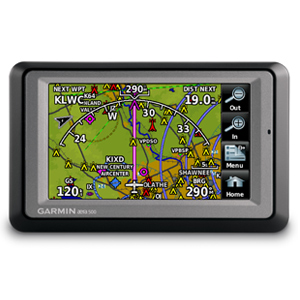 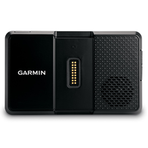 AERA 500 (aera® 500) is a model designation of portable aviation GPS receivers with touchscreen display and automotive navigation mode. In aviation mode, aera 500’s detailed chart-style shaded mapping and extensive terrain and aviation databases help you visualize your flight path in relation to nearby navaids, terrain, SUAs and obstructions. To keep you aware of special airspace activity, more than 683 parachute drop zones are detailed in the Americas navigation database. Plus, the addition of private airports and heliports to the database affords even more navigation and emergency “nearest” options. A database-driven terrain advisory feature offers TAWS-like color coding and pop-up alerts when possible obstructions or ground proximity conflicts loom. And with terrain/obstacle data shown at standard 30 arc-second resolution, you’ll enjoy a surprising level of detail on the display. Its graphical Terrain page offers both overhead and vertical profile views of the topography you’re flying over. IFR map mode lets you display and navigate on high or low enroute airways. You can also pull up MEAs (Minimum Enroute Altitudes) and distances between intersections by touching the airway on the map. The internal GPS updates at a rate of 5 times per second (5 Hz), which allows your moving map and flight data to display smoothly and continuously. And for added safety, an optional power/data cable (sold separately) makes it easy to interface aera 500 with the GTX 330 Mode S transponder in your aircraft, so you can access and display TIS traffic alerts in busy terminal airspace. You can also use the aera to load communications frequencies into your SL 40 Comm or SL 30 Nav/Comm transceiver. Original Manufacturer: GARMIN (USA) Status: in production (since 2008) Application: multiple ATA 100/JACS Code: 34-57 HTS Code: 8526 91 2099, 8526 91 2010 ► Click to view official OEM's brochure No. M02-10196-00. ContentsPart Numbers
All units goes with Worldwide Basemap and Worldwide Terrain. Features
With the addition of IFR map mode, Garmin FliteCharts® and ChartView™, the GPSMAP 695 provides key functions of a Class 1/Class 2 electronic flight bag (EFB), reducing the use of paper charts in the cockpit. When in IFR map mode, the 695 can display victor airways, jet routes, minimum enroute altitudes and leg distance, much like what’s found on traditional enroute charts. With FliteCharts, you can quickly find and view all U.S. AeroNav Services, standard terminal arrival routes (STARs), approach charts and airport diagrams. In order to install and use Jeppesen's ChartView, you will need to purchase a ChartView Key: a feature-enabling key purchased one time for the life of the device. See Garmin's instructions and video. In the Box
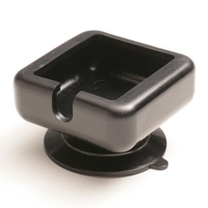
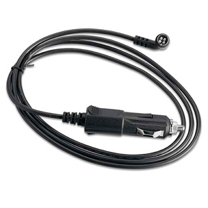
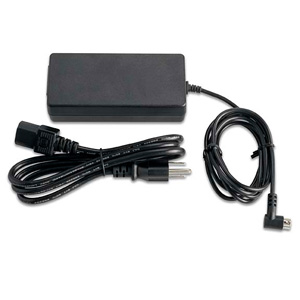
Accessories 
Specifications
ApprovalClick here to download Garmin's Declaration of Conformity. This device complies with part 15 of the FCC Rules. Operation is subject to the following two conditions:
This equipment has been tested and found to comply with the limits for a Class B digital device, pursuant to part 15 of the FCC rules. These limits are designed to provide reasonable protection against harmful interference in a residential installation. This equipment generates, uses, and can radiate radio frequency energy and may cause harmful interference to radio communications if not installed and used in accordance with the instructions. However, there is no guarantee that interference will not occur in a particular installation. Installation
Operation
MaintenanceMaintenance of the GPSMAP 695 is ‘on condition’ only. This device can be repaired only at the Garmin factory or a Garmin authorized service center. This product does not contain any user-serviceable parts. Unauthorized repairs or modifications could result in permanent damage to the equipment, and void your warranty. |